The Cosumnes River Is The Last Free-Flowing River Cascading Out Of The Western Sierra Nevada Mountains… It's Never Been Dammed!

Custom Search
Here is a fun, easy hike along a stretch of the Cosumnes River that is part of the San Joaquin - Sacramento River Delta. Actually, there are two hikes available for use.
The Cosumnes Wetlands Walk... a one mile paved or boarded walkway that allows a person to get out into the vernal pools and observe the sloughs.
The Cosumnes River Walk... a three mile meandering hike through mature valley oaks, acres of grasslands, and a riparian habitat facing the river.
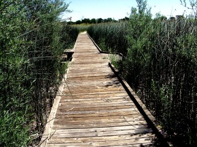
Paved boardwalks will get you out into the vernal pools
Because this is a riparian habitat and this river is uncontrolled, there is going to be seasonal flooding. This is not a big deal... it is the flooding that gives this preserve its unique personality.
The Cosumnes River walk is open year round. So, during the rainy season, caution should be taken due to the flooding. Some trails will always be open... just expect wet, muddy conditions if it is raining.
The Sacramento River Delta Has Tidal Action
80 Miles From The Ocean
Another type of flooding that occurs on a regular basis is the normal tidal action that effects all ocean exposed waterways. Although this preserve is around 80 miles inland from the Pacific, it has some elevation levels that are only around 3' above sea level.
Therefore, a 6-foot tidal action can be observed at designated points depending on the time of the year. It is pretty cool to be standing out in the middle of nowhere and watch the tide come in and go out.
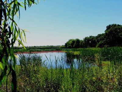
Some of these pools can rise up to 6' due to
ocean tidal action.
It is recommended that you start your hikes at the visitors center. They have all kinds of helpful information available and nice volunteers that will answer any of your questions. They do ask that you stay on the trails and not wander off on your own. There is quite a bit of protected area here.
If you are looking for some sunsets in the evening, the wetlands walk is the way to go. The walk takes you toward the west, and the area is open to a good vista.
You will have a good chance of seeing bird watchers on this trail. This walk is a nice little loop that lets you stretch your legs and gives you a chance to view over 250 species of birds depending on the time of year.
The Cosumnes River’s Riparian Habitat Attracts
Multiple Species Of Birds
Some of the more well-known species include the:
- Pelicans and Cormorants... like the American White Pelican or the Double-Crested Cormorant.
- Herons... like the Great Blue Heron or the Great Egret.
- Swans and Geese... like the Snow Goose, Canada Goose, or the Tundra Swan.
- Hawks and Allies... like the Osprey, Bald Eagle, and the Sharped Shinned Hawk.
- Cranes... like the Sandhill Crane.
The Cosumnes River Walk trail is a dirt trail, but it is level. Depending on the time of year, it is mostly dry. There are several paths to choose from, but they just loop around so it really does not matter which trail you take. However, there is only one way in and one way out. Take your time, stop and explore... and smell the smells.
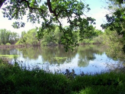
If you are quiet and patient, you may see an otter!
How To Get Here
-
Directions to the Preserve:
- Take the Twin Cities Road exit.
- Go left (east) over the freeway for approx. one mile.
- Go right (south) on Franklin Blvd. for approx. one mile.
- On the left (east), you will see the Cosumnes River Preserve and Park Headquarters.
-
From Interstate 5 coming south from Sacramento, CA
View Cosumnes River Perserve in a larger map
Leave The River Walk Trail And Return To California Hiking Is The Best Way To See The Wonders That This Diverse State Offers!
Leave The River Walk Trail And Return To The Class C Motorhome: How To Achieve The Maximum RV Lifestyle!
YOUR STORIES
1995 Tioga Montara
Had a Leak - Ouch!
A Simple Way To Put An Electrical Thermostat On A Small Space Heater
In A Truck Camper!
A Great Destinaton, With An Unexpected Outcome!
Test Link
Below: For An Alternative Destination... A Four Mile Hike Around Sugar Pine Reservoir
A Good Place To Begin The Joshua M. Hardt Memorial Trail Is At The Dam. This 3.5 Mile Trail Is Good For Foot Traffic And Bicycles... No Motorized stuff
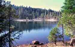
The Manzanita Day Use Area Is A Good Place To Sit And Watch The Wind
Play With The Water!
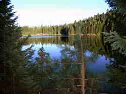
Another View From The Joshua M. Hardt Memorial Trail... Morning and Evening Are The Best Times To Hike This Trail. The Still Reflections Will Capture Your Attention
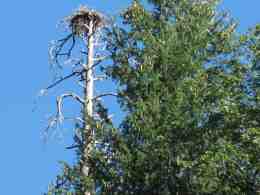
You May Want To Bring A Camera... There Are Large Birds Of Prey High In The Ski


